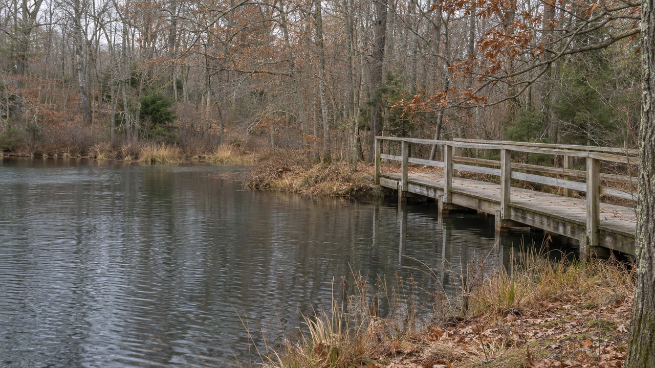
On Nov. 1, Natick opened a 195-foot floating boardwalk across Pickerel Pond in East Natick. Before it was built, getting from the north trails to the south trails meant leaving the woods, walking about a mile on Oak Street, and going back in at the other end. Now the crossing takes about a minute. The boardwalk is short, but it turns two dead-end trail systems, one off the Oakdale side and one reached from Wethersfield, into a single walk. Part of the money came from MathWorks mitigation funds that were first set aside for traffic on Route 9.
Conservation Commission Chair Matt Gardner and Select Board Vice Chair Linda Wollschlager cut the ribbon on a sunny, cool morning. Natick Report quoted Gardner at the ceremony: "This bridge has been a long time coming. This is a magnificent corner of Natick."
From a Mile of Oak Street to 195 Feet Over the Water
Pickerel Pond sat between two trail networks that never met. When Natick Report wrote about the bridge in October, the comments filled up with variations of "I've lived in Natick for X years, where the heck is Pickerel Pond?" The outlet answered with the town's trail map.
The map shows a lot packed into a small area. It labels the Cochituate Aqueduct, a North Overlook, an Island Overlook and a South Cochituate Overlook, along with town open space, state-owned open space, parking and trailheads around Oak Street, Huron Drive and Harwood Road. The 195-foot crossing is about as long as 13 cars parked end to end, by the town's own comparison. According to the July preview in Natick Report, it connects the north and south trails and, with them, the Oakdale and Wethersfield neighborhoods.
The town lists three trailheads now: Harwood Road, Erie Drive and Huron Drive. The boardwalk links the trail closest to Harwood Road with the rest of the system. Someone walking from Wethersfield and someone walking from off Oak Street can now be on the same path, and neither has to walk along the road.
How a Traffic Fund Paid for a Footpath
The connection had been on Natick's list for years. In 2023, Natick Report traced it through the town's Municipal Vulnerability Preparedness planning and the Open Space Advisory Committee, which had flagged it as a possible Community Preservation Act project. It had also come up as a possible use for MathWorks mitigation money. Natick's 2020 Open Space and Recreation Plan Update named the North-South connection as a priority action. Environmental Planner and Conservation Agent Claire Rundelli told Natick Report that the project also supports the open space goals in the town's 2030+ Master Plan.
The money came together in stages:
- 2022 Fall Town Meeting appropriated $300,000 for the project, according to Natick Report's 2023 coverage.
- October 2023 brought a $150,000 state Land and Water Conservation Fund grant.
- MathWorks mitigation funds, which the town lists for "off-road connectivity," went into the construction contract alongside the state grant.
- United Contracting was awarded the $279,000 build contract.
The MathWorks share explains why a pond trail in a residential corner of town got built at all. MathWorks paid that money through site plan review for its Apple Hill campus expansion on Route 9 east, mostly to cover traffic impacts. In January 2022, Natick Report explained that about $630,000 was left over because MassDOT had already done some of the listed projects. The same piece said trail improvements were being considered partly because they could help MathWorks employees reach the Cochituate Rail Trail and Natick Center without driving. Some of a fund created because of cars on Route 9 ended up as floating panels on a pond in East Natick.
A Bridge Built to Float
The type of bridge was chosen with the same care for cost. Rundelli told Natick Report that piered boardwalks need contractors working in the water. Floating sections can be brought into place by boat, so the crew never has to stand in the pond. "The floating boardwalk means that there is very limited disturbance needed within the wetland resource areas," she said. The town picked the shortest possible route, and it says a traditional wooden boardwalk would have cost hundreds of thousands of dollars more. The panels are anchored in the mud, with aluminum handrails and wooden stairs set into the hillside, and the town expects upkeep costs to be minimal.
The design also accounts for wildlife. The handrails are solid rather than rope so animals are less likely to get caught, and waterfowl can swim under either end. Natick Report compared it to a smaller version of the half-mile floating boardwalk on Marlborough's Lake Williams trail.
The pond itself is part of a larger plan. In 2023, the Open Space Advisory Committee recorded that Natick had been selected for a DCR grant for a stewardship plan covering the Pickerel Pond and Sunkaway area. The work included a tree inventory on 163 acres and coordination with the Nipmuc tribe and town committees.
Getting to the Bridge From Huron Drive
Natick Report's October walk-through started at Huron Drive, and its directions are the clearest way in for a first visit:
- Park on the side of the street and use the driveway at 6 Huron Drive, off Oak Street.
- Go past the metal gate.
- Turn left when you reach the fenced-off Pine Oaks Well building.
- Follow the trail past a large cement base on your right.
- Expect a rooty climb just before the boardwalk. Allow about 10 minutes from the street to the bridge.
The entrance is easy to miss. A reader who visited after the story ran wrote in the comments on Natick Report's walk-through that it sits just to the right of a large gray building with no house number. The same reader ran into many other people who had come after reading the article. On the boardwalk, which now has its handrails, you get a full 360-degree view of the pond, its lily pads and the surrounding plants.
The Wethersfield side is rougher. A reader described a stretch from Bradford Road with two narrow planks and heavy overgrowth, and the reporter said that matched their own walk.
What the Trail Is Like in Late Fall and Winter
The bridge is new, but the ground leading to it isn't. When Natick Report walked it in mid-October, the path was soggy. In February 2022, the same outlet covered both the blue and red trails from Huron Drive on packed snow and called it a good winter hike. The writer said earlier fall visits had been muddy and hard going on the old boardwalks. That winter walk also warned that the ice could break into roughly a foot of cold water. Along the way the writer passed a beaver dam and a 1953 Ford Customline partly covered in snow.
The new crossing goes over the open water those earlier walkers had to stay away from. Wildlife sightings vary from visit to visit. The October crossing turned up nothing. In September, with the bridge still taped off, a Natick Report writer turned back and spotted a barred owl after another walker pointed it out.
If you'd like a guided night walk this season, Natick Community Organic Farm at 117 Eliot St. lists a Winter Solstice Walk on Monday, Dec. 21, from 5:30 to 7 p.m.
What Changes in Spring 2027
The ribbon-cutting finished the first phase. Gardner said more work is coming:
- Box stairs at both ends of the boardwalk next spring, to make getting on and off easier.
- Native plantings to restore ground disturbed during construction.
- Upgrades to the path from Bradford Road in Wethersfield, if the town gets funding.
The July plan put the second phase on the same timeline, with stairs, vegetation management and restoration planting expected in spring depending on the weather. Until the stairs go in, expect the rooty uphill stretch just before the bridge on the Huron Drive approach. You can follow updates on the town's Pickerel Pond Connector project page and its Open Space and Trails page. For more on how East Natick fits with the rest of town, see our Natick neighborhood guide.
If you're weighing how a new trail link like this one affects a street in Oakdale or Wethersfield, Steve Leavey knows these East Natick blocks well and would be glad to talk it through. Request a Complimentary Market Consultation.